
Roxbury, Massachusetts
Want to see how Roxbury compares to other top cities in Massachusetts? Explore all city regulations in Massachusetts. →
Roxbury, MA
Generally Investor Friendly
Local STR Agent
Local STR Agent
STR Regulations for Roxbury, Massachusetts
Overview: Are short‑term rentals allowed in Roxbury, MA?
- Yes. Short‑term rentals (STRs) are allowed in Roxbury, MA, subject to City of Boston rules. Roxbury is a neighborhood within Boston, so Boston’s STR ordinance and Inspectional Services Department (ISD) program govern operations.
- Only owner‑occupied residential units are eligible: condominiums, single‑family, two‑family, and three‑family buildings. For two‑ or three‑family buildings, the owner‑occupant must own all units.
- An STR is defined as a residential unit rented for fewer than 28 consecutive days for a fee.
- There are three permitted unit types: Limited Share, Home Share, and Owner‑Adjacent. Each type has specific eligibility criteria, occupancy limits, and fee structures. Operators must register annually, include the registration number in listings, obtain a business certificate, notify abutters, and comply with taxes (room occupancy excise).
How to start a short‑term rental business in Roxbury
- Confirm eligibility before applying
- Use the City’s eligibility tool to verify your unit’s status.
- Ensure the unit is owner‑occupied and your primary residence (nine of the last 12 months, or nine of the next 12).
- Confirm there are no affordability covenants or affordability restrictions; there cannot be three or more violations in six months for noise, trash, disorderly conduct, or similar issues; and there can’t be outstanding building, sanitary, zoning, or fire code violations.
- Register the STR unit
- Submit registration to Boston Inspectional Services (ISD).
- Select the correct unit type:
- Limited Share: private bedroom(s) in owner’s primary residence; owner present during stays.
- Home Share: entire unit in owner’s primary residence; owner absent during stays.
- Owner‑Adjacent: whole unit in same two‑ or three‑family property as owner’s primary residence; owner owns all units.
- Pay the applicable fee:
- Limited Share: $25 per year
- Home Share: $200 per year
- Owner‑Adjacent: $200 per year
- Include your local contact information; this person must be able to respond in person within two hours.
- Obtain a Business Certificate
- After registration approval and fee payment, apply for a business certificate through the City Clerk’s office.
- Fees: $35 for Massachusetts residents; $65 for non‑residents conducting business in Massachusetts.
- Certificates must be renewed every four years.
- Meet operational obligations
- Display the registration number in all listings and advertisements.
- Post a safety notice inside the unit showing the locations of fire extinguishers, exits, and pull fire alarms.
- Notify abutters (any residential dwelling within 300 feet) within 30 days of registration that your unit is an STR.
- Maintain compliance with all federal, state, and local laws and codes; the unit must remain free of outstanding violations.
- Taxes and record‑keeping
- Collect and remit the Massachusetts Room Occupancy Excise Tax (M.G.L. c. 64G) on STR stays; Airbnb typically collects and remits this tax on behalf of hosts.
- Keep records for at least three years to demonstrate compliance, primary residency, ownership, and STR days.
Required documents, permits, licenses, and guidelines
-
Registration
- Application through Boston ISD Short‑Term Rental portal.
- Annual fee based on unit type.
- Registration number issued per unit; valid January 1–December 31 each year.
-
Proof of primary residence (submit at least two of the following)
- Proof of residential exemption
- Utility bill (gas, electric, oil, or water; must show service and mailing address)
- Voter registration (certificate from the Elections Department)
- Motor vehicle registration
- Deed
- Driver’s license or state‑issued ID
-
Business Certificate
- Application via City Clerk
- Filing fee: $35 (MA residents); $65 (non‑residents)
- Renewal every four years
- Registration number form from ISD must accompany the application
-
Safety and postings
- Sign posted inside unit: location of fire extinguishers, exits, and pull fire alarms
-
Record‑keeping
- Maintain records for three years: proof of primary residence days, ownership, and STR days
Specific regulations for STRs in Roxbury (city, county, state)
-
City of Boston STR Ordinance (Chapter IX § 9‑14)
- Definition: STR is renting a residential unit for fewer than 28 consecutive days for a fee.
- Owner‑occupied units only; two‑/three‑family STRs allowed only when owner‑occupant owns all units.
- Three allowed unit types with occupancy limits:
- Limited Share: three bedrooms or six guests, whichever is fewer.
- Home Share: five bedrooms or ten guests, whichever is fewer.
- Owner‑Adjacent: entire single secondary unit in a two‑ or three‑family building; occupancy limits per Boston code.
- Annual registration required; registration number must be on all listings.
- One whole‑unit listing at a time; you cannot simultaneously offer a home share unit and an owner‑adjacent unit if you are away from your property.
- Local contact must respond in person within two hours.
- Notify abutters within 300 feet within 30 days of registration.
- No affordability‑restricted units; no units subject to affordability covenants or rental assistance; no properties designated as “Problem Properties.”
- Good standing requirement: no outstanding building, sanitary, zoning, or fire code violations; violations trigger suspension of registration until cured.
-
Ineligible Units and Exemptions
- Ineligible:
- Units with affordability restrictions or subject to affordability covenants.
- Units located within a “Problem Property” or owned by a Problem Property owner.
- Units subject to local, state, or federal law prohibiting leasing or STR use.
- Units with three or more findings of violations within six months (noise, trash disposal, disorderly conduct, or similar).
- Exempt from STR definition (but may need separate licenses/permits):
- Hospital‑related stays under contract with a healthcare facility, government entity, or nonprofit; contract must describe legitimate hospital‑stay use.
- Furnished institutional/business stays (minimum 10‑day stay) with contract among building owner, corporate housing operator, and institution/business; must describe executive suite or business use.
- Lodging houses and bed‑and‑breakfasts: must register but do not pay the annual STR registration fee; lodging houses must advertise their valid Licensing Board license; bed‑and‑breakfasts must advertise their Certificate of Occupancy.
- Ineligible:
-
Taxes
- Massachusetts Room Occupancy Excise Tax (M.G.L. c. 64G) applies to STR stays; hosts must collect and remit unless a booking agent (e.g., Airbnb) does so.
- Airbnb generally collects and remits these taxes for Boston hosts; confirm coverage and register with the Massachusetts Department of Revenue if required.
-
Registration and operation specifics
- Registration runs January 1–December 31; licenses do not transfer with sale; new owners must re‑register.
- Operators must be natural persons (individuals); corporate entities are not eligible to register as operators.
- Booking agents (e.g., Airbnb) must report monthly data to the City and remove ineligible listings; agents that refuse enforcement obligations may be barred from doing business in Boston.
Contact information for local authorities
-
Boston Inspectional Services Department (ISD) – Housing Division
- Phone: 617‑635‑5300
- Email: shorttermrentals@boston.gov
- Address: 1010 Massachusetts Ave, Boston, MA 02118
-
City of Boston – Short‑Term Rentals Program
- Website: Short‑Term Rentals program page (see Sources)
- Online registration portal (see Sources)
-
Boston City Clerk – Business Certificates
- Website: How to apply for a business certificate (see Sources)
-
Massachusetts Department of Revenue (DOR)
- Room Occupancy Excise Tax guidance and registration (see Sources)
Sources (links to source pages)
-
Boston Short‑Term Rentals program overview and registration:
-
Boston Short‑Term Rental Registration portal:
-
Boston STR Ordinance (PDF):
-
Boston STR eligibility tool:
-
How to apply for a Boston Business Certificate:
-
Massachusetts Room Occupancy Excise Tax guide:
-
M.G.L. c. 64G, Section 3 (Room Occupancy Excise Tax):
-
Boston Zoning Code (Boston Planning & Development Agency):
-
Boston Licensing Board:
Notes and practical reminders
- Roxbury STRs must meet all Boston requirements; there are no separate Roxbury‑specific exemptions or caps.
- You must be the owner‑operator and a natural person; corporate ownership cannot serve as the operator for STR registration.
- Non‑conforming units that had STR leases as of June 1, 2018, were allowed a “sunset” period through September 1, 2019, or lease end—whichever came first; such units are not grandfathered thereafter unless they meet current ordinance criteria.
- Condominium associations may have additional restrictions in their bylaws; confirm compliance with condo documents before listing.
- Keep your unit free of violations; repeated or outstanding code violations can trigger suspension or revocation of your registration.
What do Airbnb hosts actually earn in Roxbury?
Roxbury hosts earn a median $51,334/year with $272 ADR and 74% occupancy.
Top performers pull in $73,405+ per year.
See the full Roxbury market breakdownNext step
Found a property in Roxbury?
Paste any address and get estimated revenue, cash-on-cash return, and comparable STR performance in under 5 minutes. 3 free analyses per day.
Free brief
Get the free Roxbury STR Investment Brief
Revenue data, top neighborhoods, seasonal trends, and the key regulations for Roxbury, Massachusetts in one email.
Roxbury
Market Saturation Score
Photos of Roxbury


Overview of Roxbury
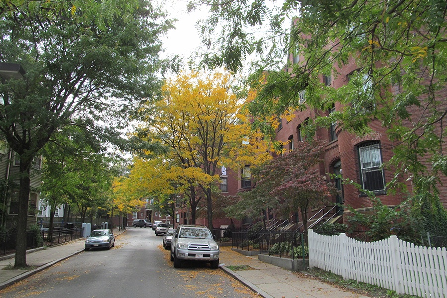
Roxbury is a historic neighborhood in the city of Boston, in Suffolk County, Massachusetts, with an approximate population of around 50,000 residents. One of the oldest communities in New England, Roxbury was originally settled in 1630 as part of the Massachusetts Bay Colony and was an independent town before being annexed by Boston in 1868. Today it is known for its deep African American heritage, its diverse community, and its collection of well-preserved colonial and Victorian architecture. As a neighborhood of Boston, Roxbury sits just a few miles southwest of downtown Boston and offers visitors a culturally rich base from which to explore the broader city.
Roxbury Heritage State Park preserves several historic sites that tell the story of the neighborhood's long and varied past. The park includes the Dillaway-Thomas House, which dates to the mid-1700s and is one of the oldest surviving buildings in Boston. The state park is located within Roxbury and is easily accessible from many short-term rental properties in the area, providing a meaningful introduction to the neighborhood's early colonial history.
The Museum of the National Center of Afro-American Artists is dedicated to preserving and exhibiting the work of Black artists and to telling the story of the African American experience. The museum, which is housed in a historic building in Roxbury, features rotating exhibitions of painting, sculpture, and photography, and it is recognized as an important cultural institution throughout greater Boston.
Adjacent to Roxbury, the Arnold Arboretum offers 281 acres of landscaped grounds belonging to Harvard University and provides a quiet escape from city life. Just a short drive from Roxbury, the arboretum contains thousands of varieties of trees and shrubs and is a popular destination for walking, jogging, and birdwatching throughout the year. Nearby Franklin Park, the largest green space in the Emerald Necklace park system designed by Frederick Law Olmsted, also offers wooded trails, a zoo, and a golf course within easy reach of the neighborhood.
Roxbury's appeal as a base for short-term rentals comes from its combination of historic character, cultural depth, and proximity to the rest of Boston. Visitors who stay here can explore local African American heritage sites, walk to nearby green spaces like the Arnold Arboretum and Franklin Park, and reach downtown Boston, Cambridge, and the broader metropolitan area within a short transit ride. For travelers who want a more authentic, community-oriented stay than a downtown hotel district typically offers, Roxbury is a distinctive and rewarding choice.
Want to know if a property in Roxbury is a good investment?
Enter an address to get instant revenue potential and comps.